Pusat Pengkajian Perencanaan dan Pengembangan Wilayah (P4W)-LPPM IPB menyelenggarakan Konferensi Internasional The 6th International Conference of Jabodetabek Study Forum 2018 yang diselenggarakan pada tanggal 29 Agustus 2018. Konferensi Internasional ini dilaksanakan di IPB International Convention Center, Bogor dengan tema “Urban-Rural and Upland-Coastal Connectivities in Managing Sustainable Urbanizing World”. Pusat Pengkajian Perencanaan dan Pengembangan Wilayah (P4W)-LPPM IPB ikut berpartisipasi dalam kegiatan Konferensi Internasional tersebut dengan memaparkan paper hasil penelitian terkait subtema Land Use Cover Changes and Watershed Management dengan judul “The Dinamics of Abandoned Land in Upstream of Ciliwung River Watershed” Paper tersebut ditulis oleh Setyardi Pratika Mulya, S.P., M.Si; Dr. Ernan Rustiadi; Wildia Firman Chan, S.P. dan Dr. Andrea Emma Pravitasari.
Berikut merupakan bagian abstrak paper.
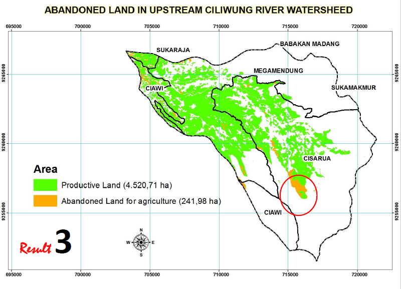
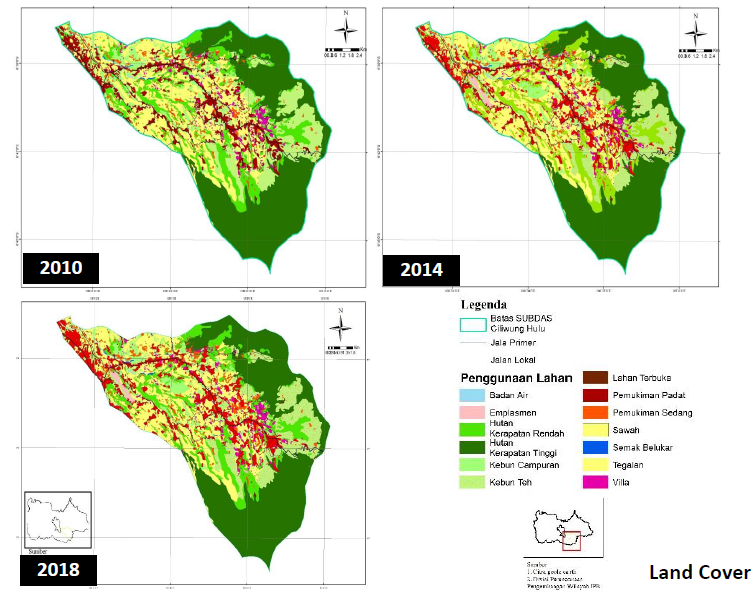
The agricultural issues have always related to land use allocation. The main issues in agricultural land use allocation in Indonesia are: the limitation of suitable land resources, un- conformity with policy (spatial plan), imbalance land tenure between corporate and household farming and the increase of domination of smallholder farmers (<0.5 ha/family). The conversion of fertile agricultural land into built-up/settlement areas has become the main issues in food-agricultural system, including land use in Ciliwung River watershed as well as environmental issues. This study had conducted in Upstream of Ciliwung River Watershed, Bogor District. The study area is consisting of four sub districts (kecamatan), namely Megamendung, Cisarua, Sukaraja and Ciawi sub districts. The objectives of this study is to identify the distribution of abandoned agricultural land (non-productive) and land status based on policy (spatial plan and land ownership). The study was conducted to identify physical land characteristics, economic activities as well as formal land status. We employed geographical information system tools, and descriptive analysis.