Dynamics and Predictions of Land-Use Changes in Serang Raya and Their Conformity to the Spatial Plan of Banten Province

Author: Oki Libriyanto, Andrea Emma Pravitasari, Muhammad Ardiansyah
Abstract: Serang Raya is developing rapidly, characterized by the growing population, and increasing socioeconomic activities would
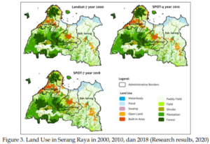
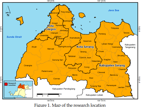
threaten the sustainability as one of the food storage areas and guard the natural ecosystem in Java. The need for urban land may lead to land use with various protection functions and productive agricultural land, resulting in a decrease in food production and environmental degradation. This study aims to analyze the dynamics of land-use change in Serang Raya in 20002018, to predict land use in 2030, and to analyze the unconformity between land use in 2018 and the expected land use in 2030 with the spatial plan of Banten Province 2010-2030.
The analytical methods used image interpretation, CA-Markov land use predictions, and overlay analysis to identify unconformity. The results showed that land use in Serang Raya had changed with a dominant pattern of change: rice fields became open land, plantations became built-up areas, and rice fields became built-up areas. Prediction of land use in 2030 shows an increase of built-up area, which is relatively high along with a decrease in paddy fields and plantations. The existing land use conditions in 2018 led to unconformity with the space allocation of 8.92% and increased to 9.31% compared to the predicted land in 2030.
Keywords: Spatial Unconformity, Land Conversion, Land Prediction
Journal URL: https://jurnal.unimed.ac.id/2012/index.php/geo/article/view/24441
