
 Indonesia
Land cover changes and spatial planning alignment in Ciamis Regency and its proliferated regions
 Author: Andrea Emma Pravitasari, Fakhruddin Putra Yudja, Setyardi Pratika Mulya, and Yuri Ardhya Stanny
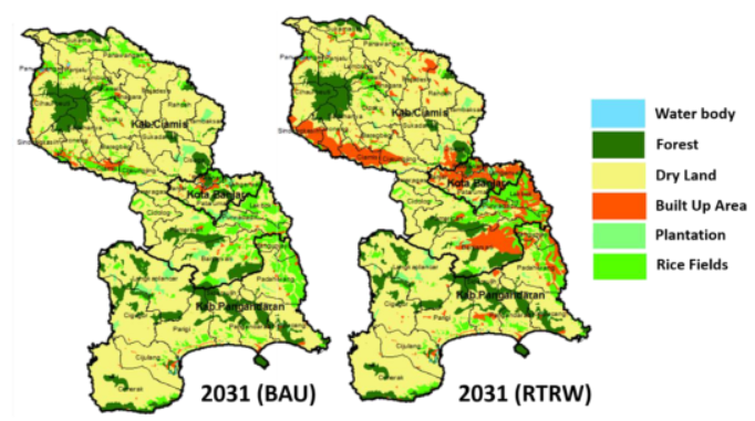
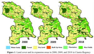
Abstract: Ciamis Regency experienced regional proliferation and land cover change dynamics. Information on existing and predicted land cover is needed to ensure alignment with spatial planning (RTRW). This study aims to: (1) analyze land cover change in Ciamis and its proliferated regions (2000-2018); (2) examine land cover prediction in 2031; and (3) analyze the alignment between land cover (2018) and predicted land cover (2031) with RTRW. Spatial analysis and Land Change Modeler were employed using ArcGIS and Idrisi Selva software. The alignment between land cover and RTRW was identified by a logic matrix based on land rent in 2031 with RTRW of Ciamis Regency, Banjar City, and Pangandaran Regency. The results showed that dry land dominated the 173,949 ha land cover in 2000 and increased to 183,231 ha in 2018. During 2000-2018, there was a decreasing trend in rice fields. The predicted land cover (2031) based on BAU and RTRW scenario shows that rice fields tend to decrease, while the built-up area has a significant increase. The alignment of RTRW with land cover (2018) is 97%, whereas its alignment with predicted land cover (2031) is 96% (BAU) and 93% (RTRW). The results are beneficial for land management and controlling land conversion.