English
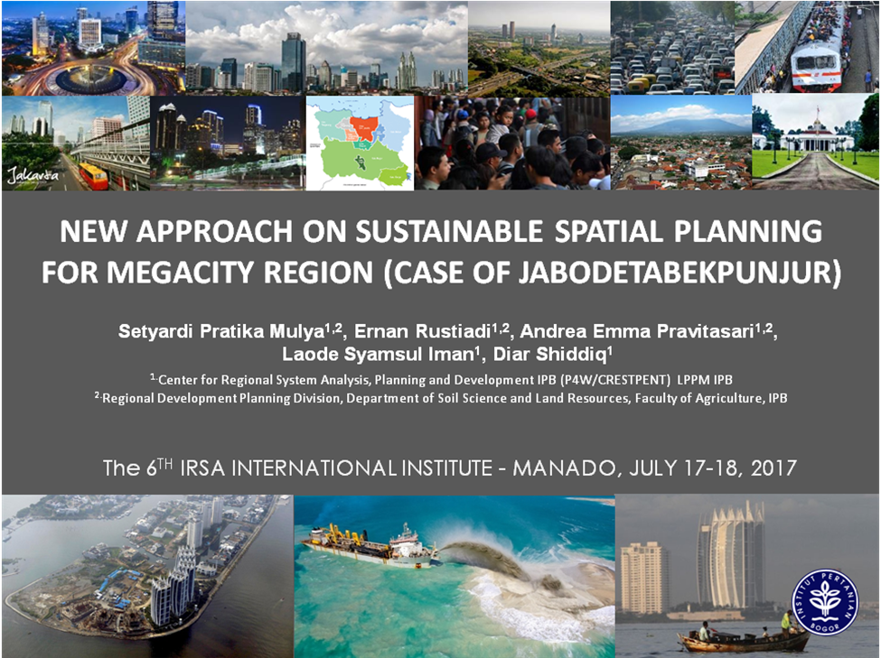
New Approach on Sustainable Spatial Planning for Megacity Region (Case of Jabodetabekpunjur)

Indonesian Regional Science Association (IRSA) berkolaborasi dengan Fakultas Ekonomi dan Bisnis, Universitas Sam Ratulangi menyelenggarakan konferensi internasional “The 6th Indonesian Regional Science Association (IRSA) International Institute” pada tanggal 17-18 Juli 2017. Konferensi ini dilaksanakan di Universitas Sam Ratulangi Manado, Sulawesi Utara dengan tema “Maritime Infrastructure and Regional Development”. Pusat Pengkajian Perencanaan dan Pengembangan Wilayah (P4W) ikut berpartisipasi dalam kegiatan konferensi internasional tersebut dengan memaparkan paper hasil penelitian dengan judul “New Approach on Sustainable Spatial Planning for Megacity Region (Case of Jabodetabekpunjur”. Paper tersebut ditulis oleh Setyardi Pratika Mulya, S.P., M.Si; Dr. Ernan Rustiadi;. Dr. Andrea Emma Pravitasari; Laode Syamsul Iman, S.P., M.Si dan Diar Shiddiq, S.P., M.Si. Berikut merupakan bagian dari abstrak paper.
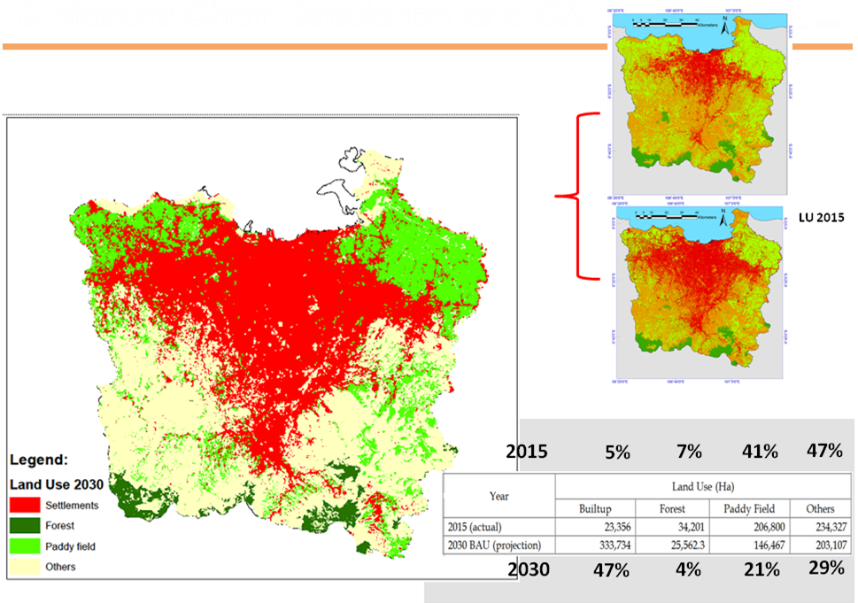
The National Spatial Plan (RTRWN) set up the Jakarta megacity region or Jabodetabekpunjur (Jakarta, Bogor, Depok, Tangerang, Bekasi, Puncak, and Cianjur) as National Economic Strategic Area (KSN). The central government is in the process of reviewing and revising the spatial plan of Jabodetabekpunjur region by considering environmental carrying capacity of the region. Due to the emergence of various environmental issues in the region, a new approach in spatial planning that takes into account the environmental carrying capacity to ensure sustainable development is needed. This study aims to: (1) determine the environmental carrying capacity of Jabodetabekpunjur region based on settlement land capability and land suitability, (2) Identify settlement areas facing environmental pressures, and (3) identify typology of spatial control based on a combination of carrying capacity, space allocation and existing land uses. This study employed a set of spatial analysis, satelite imagery interpretation, geographic information system (GIS) analysis, identification of existing land use, forecasting city land use changes by Cellular Automata (CA)-Markov analysis, and land suitability analysis for settlements. The landsat imagery data of the year 1983, 2000, and 2015 were used. The land suitability analysis was conducted based on the actual land suitability or no-technology input assumption.